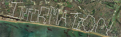
 digital marking using GPS satellite navigation technology. the huge-scale drawings are of journeys captured using GPS receivers, created by treating travel like a geodetic pencil or a cartographic crayon in the air, over land or on water. some drawings are superimposed with information, such as heart rates, activities & physical places. []
 Time and Date follows Time Zone (Brussels)