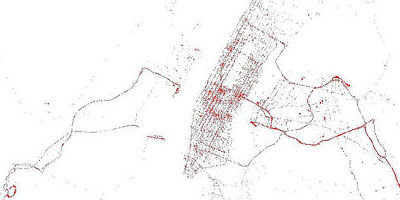
 a 'street usage' visualization based on the real-time maps that display the geographical position of (buses that travel between hotels & airports) in New York. this map is generated from data gathered over 5 days, queried every 5 minutes, with each red dot representing a single SuperShuttle. one can clearly perceive the Manhattan outlines, possible coffee shops in Queens & favorite traffic bottle necks (e.g. bridges & tunnels). [ & ]
 Time and Date follows Time Zone (Brussels)