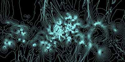
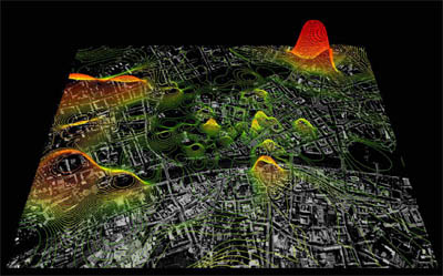
 several real-time maps titled 'Digital Derive' that visualize the volume & geographic source of cell phone usage in Graz, showing a visual conceptual layer in the use & experience of the city. thousands of mobile phones are simultaneously 'pinged' to establish their precise location in space at a given moment in time. for the first time, a high amount of mobile phone devices are used as highly dynamic tracking tools that describe how the city is used & transformed by its citizens.
the digital maps can be experienced in real-time as they constantly transform & shift in status, & act as means of observing & reading the city, its evolution & fluctuation. museum visitors can register their personal mobile phones which then become traced & highlighted on the map.
the project will be shown at the M-City exhibition (Kunsthaus Graz, Austria, Oct 2005 - Jan 08 2006). [ & (pdf)|thnkx Serhat]
MORE
 Time and Date follows Time Zone (Brussels)
The historic city centre of Graz was awarded World Cultural Heritage by UNESCO in 1999...read more