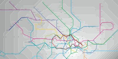
a redesigned London Underground map that combines geographically accuracy with the travel times required between successive subway stations. the map uses time as scale, with each zone representing 5 minutes. see also personal world map for a similar time-based but interactive approach. []
 Time and Date follows Time Zone (Brussels)