
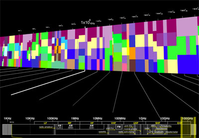
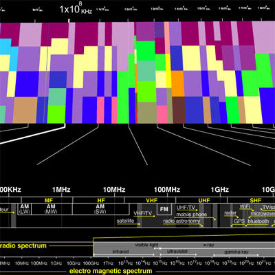
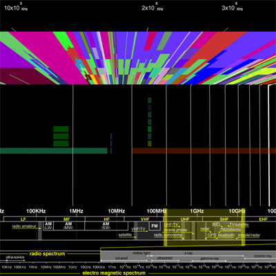
an impressive 3D navigable representation of the services that use our electromagnetic radiospectrum, ranging from 10Khz "radio navigation" to 100Ghz "inter-satellite communication".
the "services" view shows the range of applications (e.g. mobile, satellite, broadcasting) sorted by electromagnetic frequency, while the "projects" view documents different art works that have been based on specific spectrum zones (with accompanying descriptions & videos).
[link: & |thnkx Tom]
 Time and Date follows Time Zone (Brussels)
here's my post on the atlas from yesterday:
http://flowingdata.com/2008/03/16/interact-with-the-atlas-of-electromagnetic-space/
thnkx Nathan, you seem to have beaten me with the scoop. (& cool blog you have!)
infosthetics gives me something to shoot for :)